felix luginbuhl
home
posts
projects
apps
talks
about
Get the code:
Once you subscribed, you will receive an email with the URL of my GitHub repository.
Categories
All
(11)
Posts and Videos
Blog post,
YouTube Videos
, and Data Visualisations.
Order By
Default
Title
Date - Oldest
Date - Newest
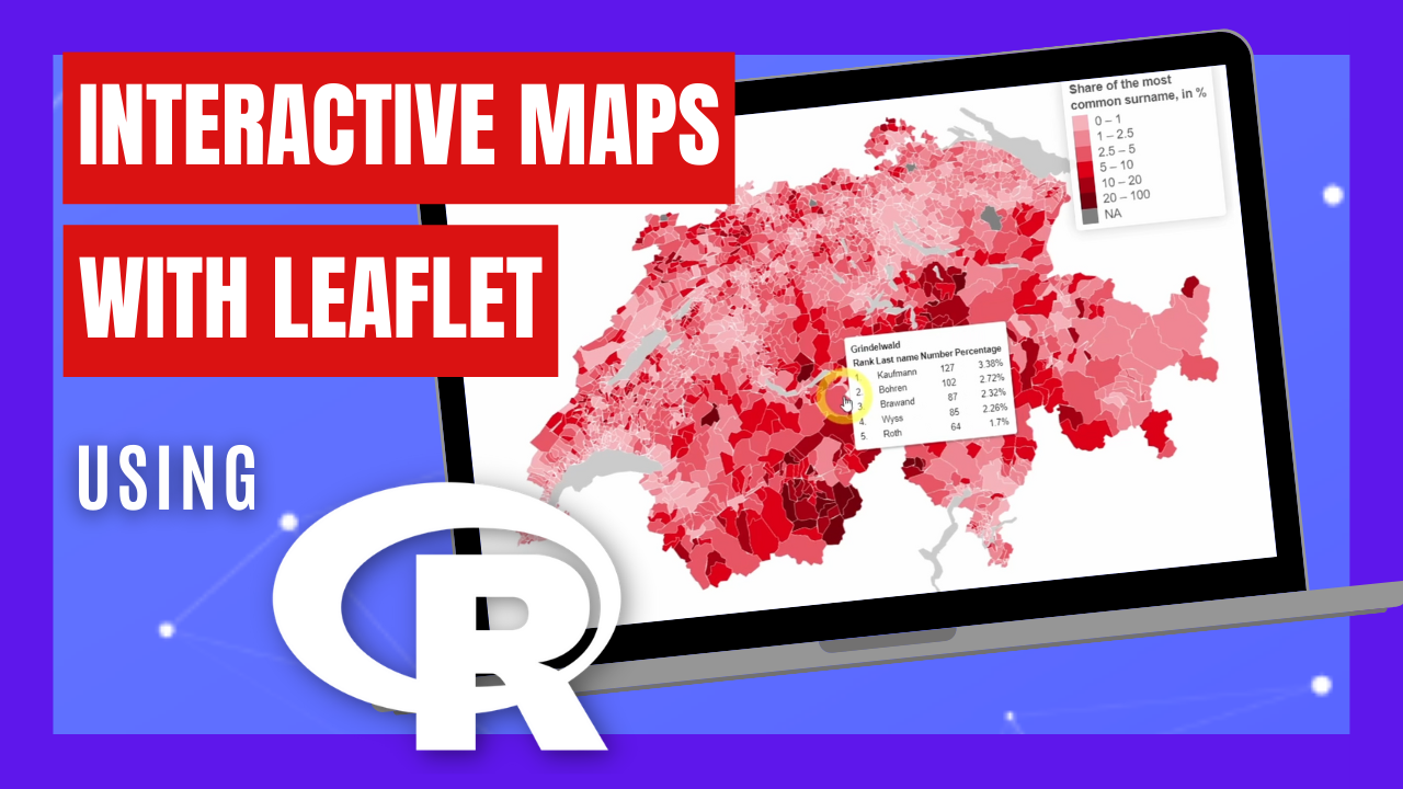
Customized Leaflet map using R
Reproducing an official Swiss map of the top surnames by commune with leaflet
Oct 1, 2023
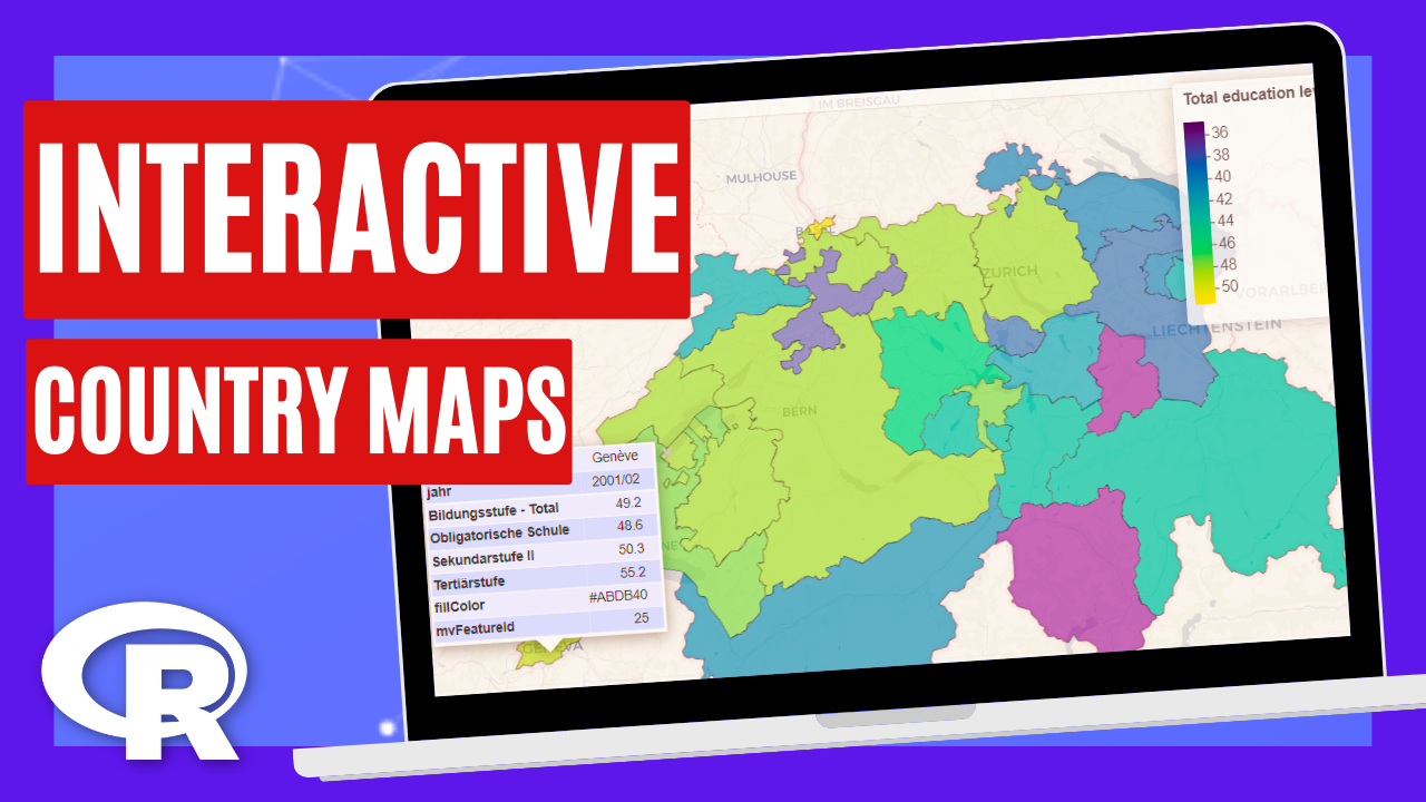
Interactive Country Maps with R
Learn how to create Interactive Maps of any European Country using R programming.
May 23, 2023
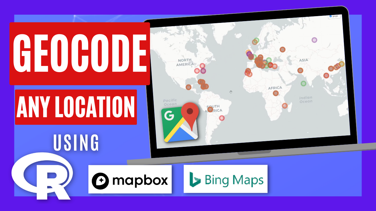
Geocode ANY location using R
Get the latitude and longitude of any place using Google Maps, Bing or Mapbox.
Apr 18, 2023
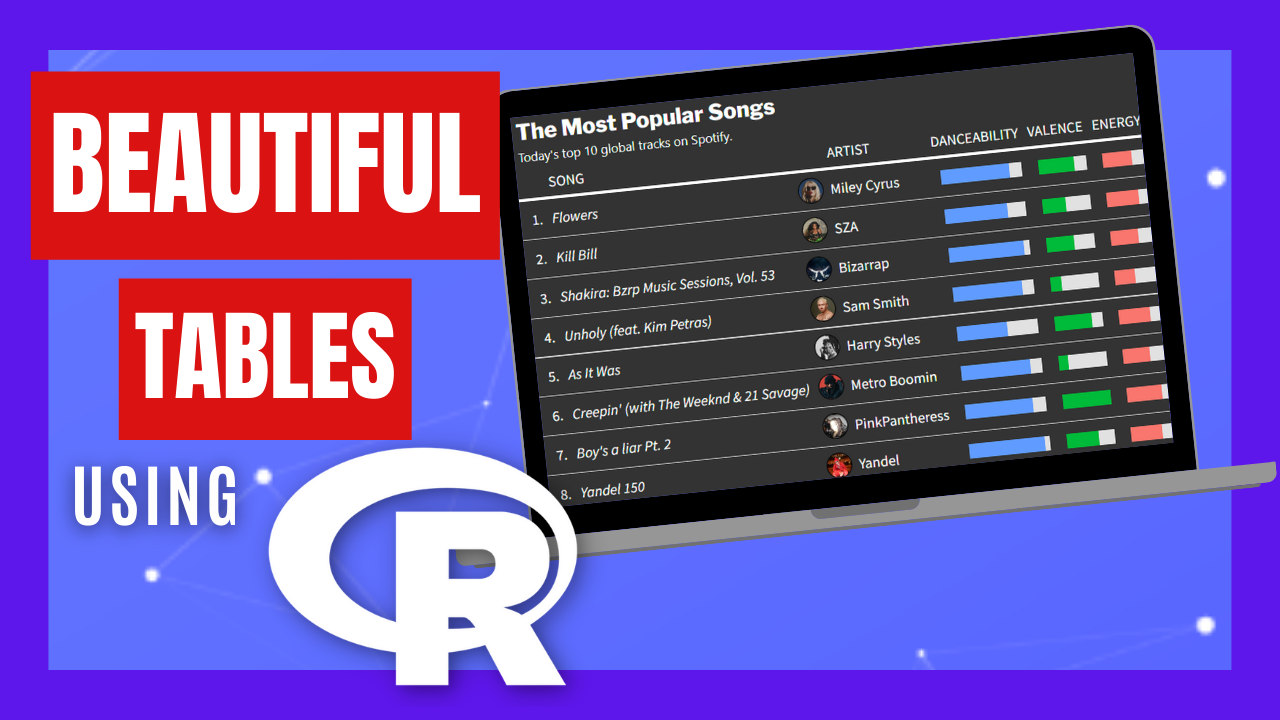
Make Beautiful Tables using R
Fully customize your tables with colors, images and graphics with gt.
Mar 1, 2023
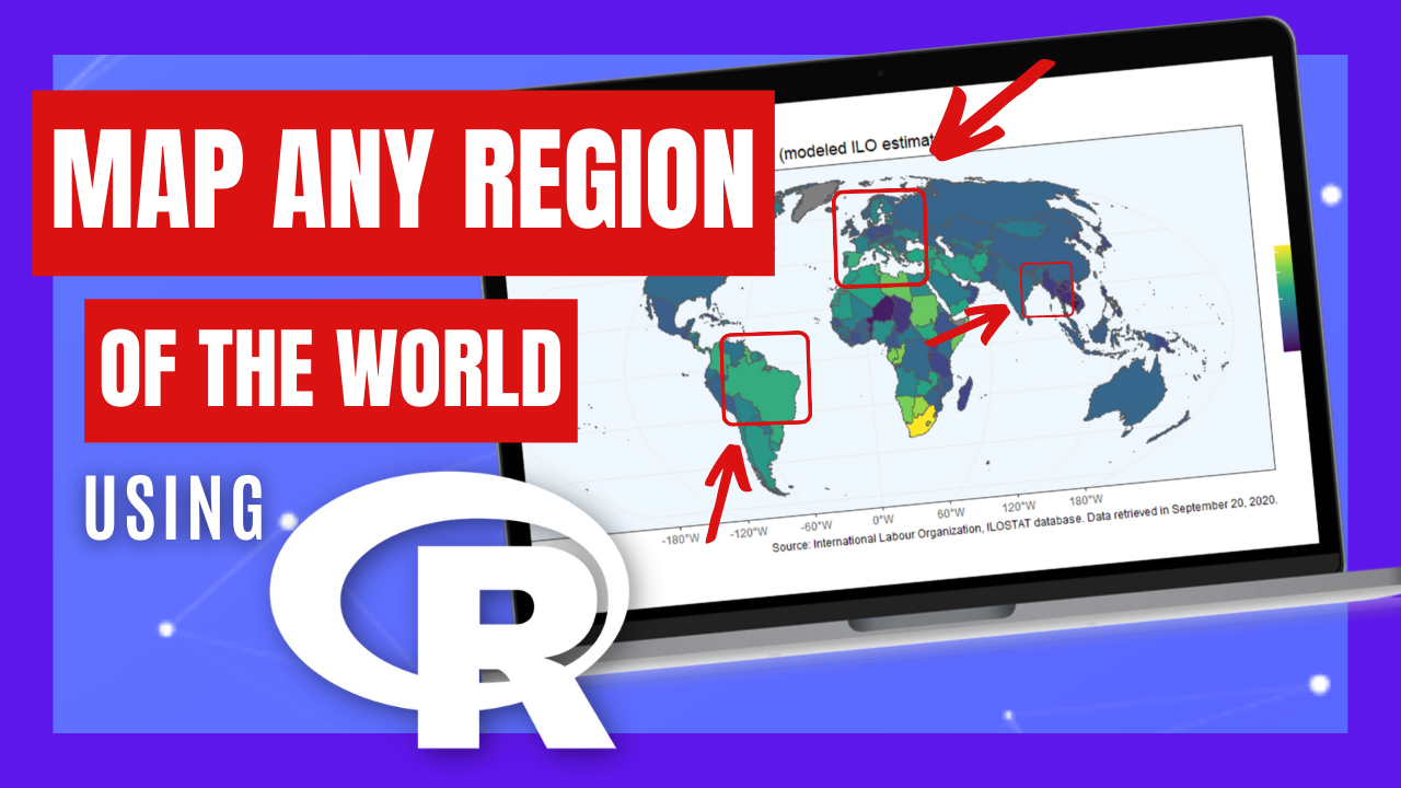
Map ANY region of the world using R
Using R programming to Map Europe, Asia, Africa, America, etc.
Jan 29, 2023
Google Sheet Automation using R
How to read, write, append data, and change Google Sheet user permissions from R.
Dec 26, 2022
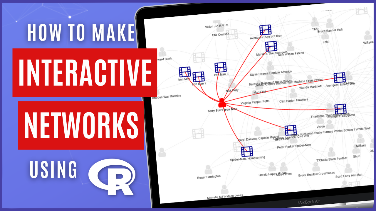
Interactive Network of the Marvel Universe
Learn how to use R programming to create interactive networks.
Nov 8, 2022
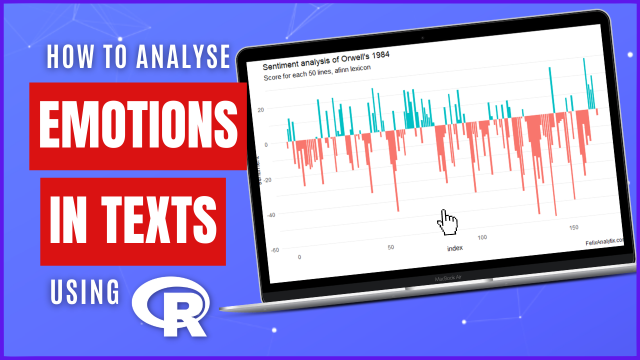
How to Detect Emotions 😍😭😱 from Texts
A sentiment analysis of George Orwell’s 1984 novel using tidytext
Aug 16, 2022
Read, Clean and Merge Excel files using R
Clean, validate and join Excel files in a single and consolidated dataset
Jul 5, 2022
Advanced Data Filtering in R using dplyr
5 advanced examples using the filter() function from dplyr
Mar 3, 2022
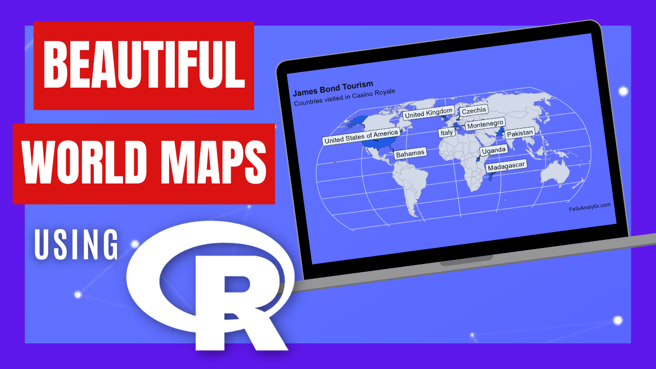
Beautiful World Maps using R
Mapping James Bond country locations by movie and actor with ggplot2 and sf
Feb 11, 2022
No matching items